
Happy February from the Imagine Madison Team! We’re glad you didn’t get stuck in Groundhog Day timeloop. If you did, this whole “planning for the future” thing would be weird.
While Phase 1 will continue for about one more month, we are starting to look forward to Phase 2 of the Imagine Madison process. Land use will be a key component in Phase 2. We’ll be updating the Future Land Use Map that includes the planned land uses for currently developed areas and anticipated growth areas on the edge of the City. To ensure that the Comprehensive Plan is an accurate expression of community land use goals, we’ve established a process for considering changes to the Plan’s Future Land Use Map and the corresponding text in the Plan.
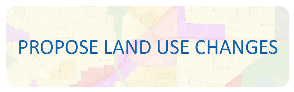
The City Planning Division will accept change requests regarding the Future Land Use Map and Chapter through March 31. It is preferred that requests be submitted online at www.imaginemadisonwi.com/land-use-map-amendment. We are looking for input from residents, neighborhood associations, developers, and all other interested parties. Planning Division Staff will review comments and evaluate requests to create an Initial Draft of the Future Land Use Map, which will be presented for a two-month public comment period beginning in late April. The Final Draft of the Future Land Use Map will be presented to the Plan Commission at a public meeting in July.
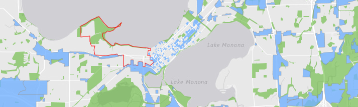
Land use, as described above, is what most people think of when talking about the Comprehensive Plan. Specifically, what are the existing land uses and will those land uses change? But when we compare the Current Land Use Map with the Future Land Use Map, it's almost impossible to see which areas are most likely to change. Many people want to know: are there areas that may change where I live? Planning staff developed a list of criteria to inform development of an "areas of potential change" map to easily show which areas of the City are most likely to see changes over the next 20+ years. You can now view the Areas of Potential Change story map that shows the various criteria used for determining areas of potential future change, as well as a delineation of those areas that, due to demographic and economic forces, are more likely to change development type, density, or intensity by 2040. Take a look here.
Issues & Goals Survey
Time is running out to weigh in on our Draft Goals that will set the stage for the remainder of this project. We’ll be closing down the survey on February 15th so we can compile the responses, add them to the feedback from public meetings and Resident Panels, and report out to the Plan Commission and the public. Go to http://www.imaginemadisonwi.com/issues-goals-survey to let us know your thoughts about Madison’s direction regarding housing, transportation, and much more.
For more information regarding the Future Land Use Plan, the Areas of Change map, the Issues and Goals survey, or anything else about Imagine Madison, contact us using the information below.
Brian, Colin, and Kirstie
City of Madison Comprehensive Plan Update
608.243.0455 | 608.243.0470
imaginemadisonwi.com | Facebook | Twitter

Add new comment